
Blue Springs ZIP Code Coverage
State and city material identifies 64013, 64014, and 64015 as Blue Springs’ core postal associations. The research also found nearby or service-area labels that matter when an address search reaches the edge of the city. The table keeps those categories separate. A postal city, a utility area, and an incorporated municipality answer different questions, so none should be substituted for a parcel or annexation record.
| Postal label | Verified Blue Springs connection | Post office or postal city | Research caution |
|---|---|---|---|
| 64013 | Blue Springs PO-box and city association; city HOA records | Blue Springs association | Older geocode material labels it P.O. Boxes, not a residential boundary |
| 64014 | Core and east Blue Springs association | Blue Springs Post Office, 500 SW South Avenue | Delivery route is not a city-limit line |
| 64015 | Core and west Blue Springs association; City Hall use | Blue Springs postal city | No block-level municipal crosswalk was located |
| 64029 | City-related utility and boundary-discussion areas | Grain Valley postal city or route | Confirm the parcel and annexation record |
| 64064 | City-related utility and boundary-discussion areas | Lee’s Summit postal city or route | Do not equate a service area with incorporation |
| 64057 | Blue Surf Bay service-area evidence only | Station or route not verified | No official block-level Blue Springs city-limit proof located |
| 64086 | Blue Surf Bay service-area evidence only | Station or route not verified | No official block-level Blue Springs city-limit proof located |
The Missouri county/city/ZIP table, published November 15, 2025, associates Jackson County with Blue Springs postal labels 64013, 64014, and 64015. The remaining rows are included because research may surface them beside city utilities, recreation services, annexations, or an address record. They are leads to test, not proof that every delivery address belongs to Blue Springs.
Blue Springs ZIP Directory Clues
64014 has the clearest postal-service detail in the research. The Blue Springs Post Office is at 500 SW South Avenue, Blue Springs, MO 64014-9998. Its listed retail hours are Monday through Friday from 8:30 a.m. to 5 p.m. and Saturday from 9 a.m. to noon, with phone number 816-220-0820. Those facts verify a postal station and its services. They do not define every parcel that uses the label.
See the USPS Blue Springs Post Office listing for the station’s published details.
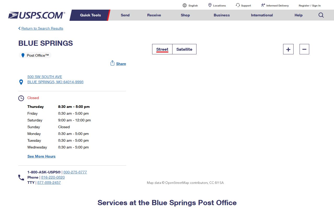
The USPS listing helps verify delivery service and a complete address. It should be paired with county parcel evidence when the record question concerns Blue Springs municipal status.
64013 needs a different reading. Older Missouri geocode material identifies a Blue Springs P.O.-box association, and city HOA records use the label. The research did not locate a current official route-by-route description, so it is safer to retain the dated PO-box clue than to treat 64013 as a complete residential outline.
Search Blue Springs by ZIP
A postal label can narrow an address question, but the reviewed county and state tools do not offer a universal ZIP-wide resident list. The Collector screen exposes property-address, owner, mailing-address, and PIN modes, not a verified stand-alone ZIP control. The Missouri Voter Outreach Portal requires exact identity details and county, not a ZIP filter. Use the postal label to verify the address first, then use the record system that matches the question.
- Check the complete delivery address through USPS and write down the postal label exactly as returned.
- Search the address in the Jackson County Collector property search using Property Address. Record the PIN, situs, and result count.
- Open the parcel in the Jackson County GIS Parcel Viewer to compare the legal description, mapped context, and districts.
- Use city annexation files, plats, or agendas when municipal status remains uncertain. A ZIP result does not resolve incorporation.
- For registration or district information, use the Missouri Voter Outreach Portal with the required exact identity fields, or send a focused request to the Jackson County Election Board.
Once the parcel is narrowed to a particular road, the Blue Springs street directory has the address-by-address record trail. It is the better route for a legal-description or deed question than a postal label alone.
Blue Springs ZIP Search Fields
The Collector’s inputs are useful because they show what the system actually accepts. Use an address value only after testing the live form. Research did not verify a separate ZIP field, so no ZIP-wide results should be promised from that portal. Broad results can reach 200 records, and the asterisk wildcard is available when an exact term is uncertain.
| Portal field | Field type | What it helps confirm | ZIP-specific limit |
|---|---|---|---|
| Property Address | Text | Situs location and its linked property account | ZIP control was not visible in the inspected form |
| Primary Owner | Text | Property account indexed to an owner | Owner is not an occupancy finding |
| Mailing Address | Text | Tax correspondence address | May be outside the parcel’s postal or city area |
| PIN | Number pattern | Known property account | Use after an address search identifies the parcel |
The GIS card adds the parcel’s legal description, owner and mailing fields, districts, map, PDF, and related property tools. GIS dimensions are not survey-grade, and easements should be researched through the Recorder rather than inferred from the map.
Blue Springs Postal District Checks
A delivery label does not answer a precinct, ward, or district question. The Jackson County Election Board voter-information route can provide registration, voting-district, ballot, and poll-place details where available. Its jurisdiction note matters because Kansas City residents use the Kansas City Election Board. For an address that looks close to a municipal line, first confirm the parcel and city status, then use the correct election authority for the voter or district question.
The Missouri Voter Outreach Portal is not a location-browse tool. It asks for the registered first and last name, date of birth in MM/DD/YYYY form, final four Social Security digits, and county, with all fields required in the inspected form. Exact matching matters. A different given name, a county mismatch, protected record, or portal limitation can produce no result. Do not use a postal label as a substitute for the identity details the system requires.
For public voter lists, maps, or history, the Jackson County Election Board has a written request form that allows Documents, Maps, Voter Lists, or Other and asks for a specific date period. Delivery options include email, flash drive, CD, or paper. The form states that the agency responds by the end of the third business day, excluding weekends and legal holidays, or explains a delay, added time, charges, or legal basis. Protected addresses and the statutory use limits still apply.
Blue Springs Postal Boundaries
Blue Springs municipal records can sit beside Grain Valley 64029 or Lee’s Summit 64064 postal labels. The city’s 2008 archive includes a request asking USPS to align postal designations with municipal boundaries in those areas. It discusses 64014 east of Missouri 7 and 64015 west of Missouri 7, but it is a city request, not proof of a later route change or an address-by-address boundary. City utility listings also reference 64014, 64015, 64029, and 64064, yet a utility service area is not an incorporated-city map.
- ZIP code
- A USPS delivery geography used to route mail. It is not a municipal boundary.
- ZIP+4
- An added four-digit delivery detail that further narrows mail handling within a ZIP area.
- PO-box ZIP
- A label associated with post-office boxes. It should not be read as a full residential area without current route evidence.
- Carrier route
- A postal delivery grouping used by USPS. It does not establish city incorporation or parcel boundaries.
- ZCTA
- A Census statistical approximation of ZIP geography, useful for broad data but not for a particular parcel.
For a precise answer, compare the parcel GIS record with a plat, annexation file, or city map. The research found no official block-by-block crosswalk from every postal label to Blue Springs city limits.
Blue Springs Annexation ZIP Records
Annexation material explains why a postal city and a municipal record can tell different stories. The Blue Springs application asks for owners, legal description, survey or map, acreage, parcel number, section, township, range, proof of ownership, existing uses, and contiguous holdings. It also describes notice to owners within 185 feet and newspaper publication. Those fields create a reproducible parcel trail when a postal label has not changed with a city boundary.
Check the Blue Springs Agenda Center for current project identifiers, public-hearing dates, exhibits, and final action.
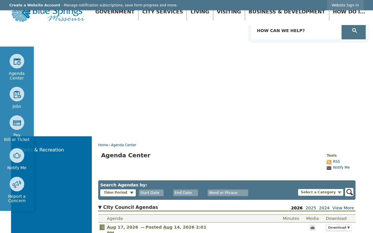
The 2026 agenda includes the Colbern Annexation and Ford Warehouse identifiers, among other planning matters. Preserve the agenda date, project number, legal-description exhibit, and ordinance or minutes rather than relying on the postal label as the whole location record.
Blue Springs ZIP Directory Limits
A Blue Springs postal search can organize an address question, but it cannot prove every fact about a parcel or a person. USPS verifies mail service. The Collector and GIS systems provide assessment and mapping context. The Recorder supplies legal instruments. The Election Board and state voter portal have distinct access rules, required fields, and protected addresses. Treat a missing result as a reason to check the address form, jurisdiction, privacy rule, city record, or office request route, not as proof that no record exists.
Boundary check. Write “postal result” until the county parcel record and the relevant city or annexation evidence confirm the municipality for a Blue Springs address.
Use address, parcel, and office records for personal, lawful research only. Preserve the search date, address form, parcel identifier, and source link when comparing sources. That small record makes it clear whether a difference comes from a postal route, a recent annexation, an old city file, or a protected-record limit. If a question remains unresolved, request the specific municipal or county record rather than broadening the search. Do not use geographic results to stalk, harass, intimidate, or harm anyone.